
On PTV Developer, POIs (Point Of Interest) are called Places, and you could already search for them with the PTV Geocoding & Places API. Two things are new now: you can search a whole category branch in one go, and you can show Places right on the map.
New: search a whole branch in one go
Places sit in categories, organized in a tree up to three levels deep. “Business and services” is one such branch, covering fuel stations, EV charging stations for cars and for trucks, truck parking, banks, and dozens more.
Until now, getting a whole branch meant listing every subtype by hand. Now, one identifier returns the whole branch: search “fueling stations” once, and get every matching Place back, fuel pumps, EV charging points and everything else in that branch, without listing each subtype yourself.
New: show Places on the map
PTV Developer’s Vector Maps API now has a Places layer. Switch it on, and the map draws categorized Places as icons: fuel pumps, EV charging stations, truck parking, shops, airports and more. Each icon carries its category, name and other details, and can open a pop up with more information.
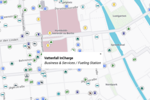
Visibility is zoom dependent and tuned for logistics: zoomed out, only the most prominent categories appear, and zooming in reveals more. You stay in control: any category can be switched on or off, so a map can show just fuel and truck parking, for example.
One shared category tree
Both new capabilities use the same category tree. Pick “fuel” once in your app, and that single choice narrows both the search and what appears on the map. Nothing needs to be translated between the two.
What this looks like in practice
- Corridor planning: filter the map to fuel, EV charging and truck suitable parking, and switch the rest off.
- Category search: search “charging” or “parking” as one group, and get complete results back in seconds.
- Route context: find Places by category, show them on the map, then add one as a stop in the PTV Routing API.