
Where exactly is a postcode? When you only have the code and no street, a geocoder still needs to return a single point on the map. Until now, the Geocoding & Places API picked that point by calculating the centroid of all street segments assigned to that postcode. The problem: a centroid can land somewhere nobody lives.
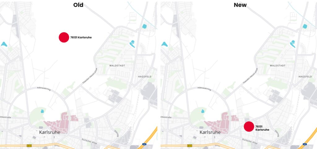
Take postal code 76131 in Karlsruhe: the geocoder placed it out in the woods, even though anyone familiar with the area would point straight at the city center. This update closes that gap between the mathematically correct answer and the one that’s actually useful.
Largest neighborhood wins
When a postcode covers multiple neighborhoods, its centroid can end up between them, somewhere nobody lives. The geocoding data now groups segments by neighborhood and picks the one with the most street segments. That’s almost always the town or city where most people live, so the returned point lands there instead of on open ground.
When a postcode has no dominant neighborhood but only a scatter of small villages, the center can still miss the mark: no data can invent a center that doesn’t exist. But even then, you get the most useful coordinate for a postcode search.
What this means in practice
Nothing changes in the API, same request, same fields, better point. But the improvement matters wherever a postcode is geocoded without a street address. Territory planning, depot assignment, and rough distance estimates all start from that single point. If it’s off, everything built on top of it carries that error forward.
With the point now landing where people actually live, there’s less manual correction and less distortion in routing or matrix calculations.